Water in Muskoka – By the Numbers
By Rebecca Willison.
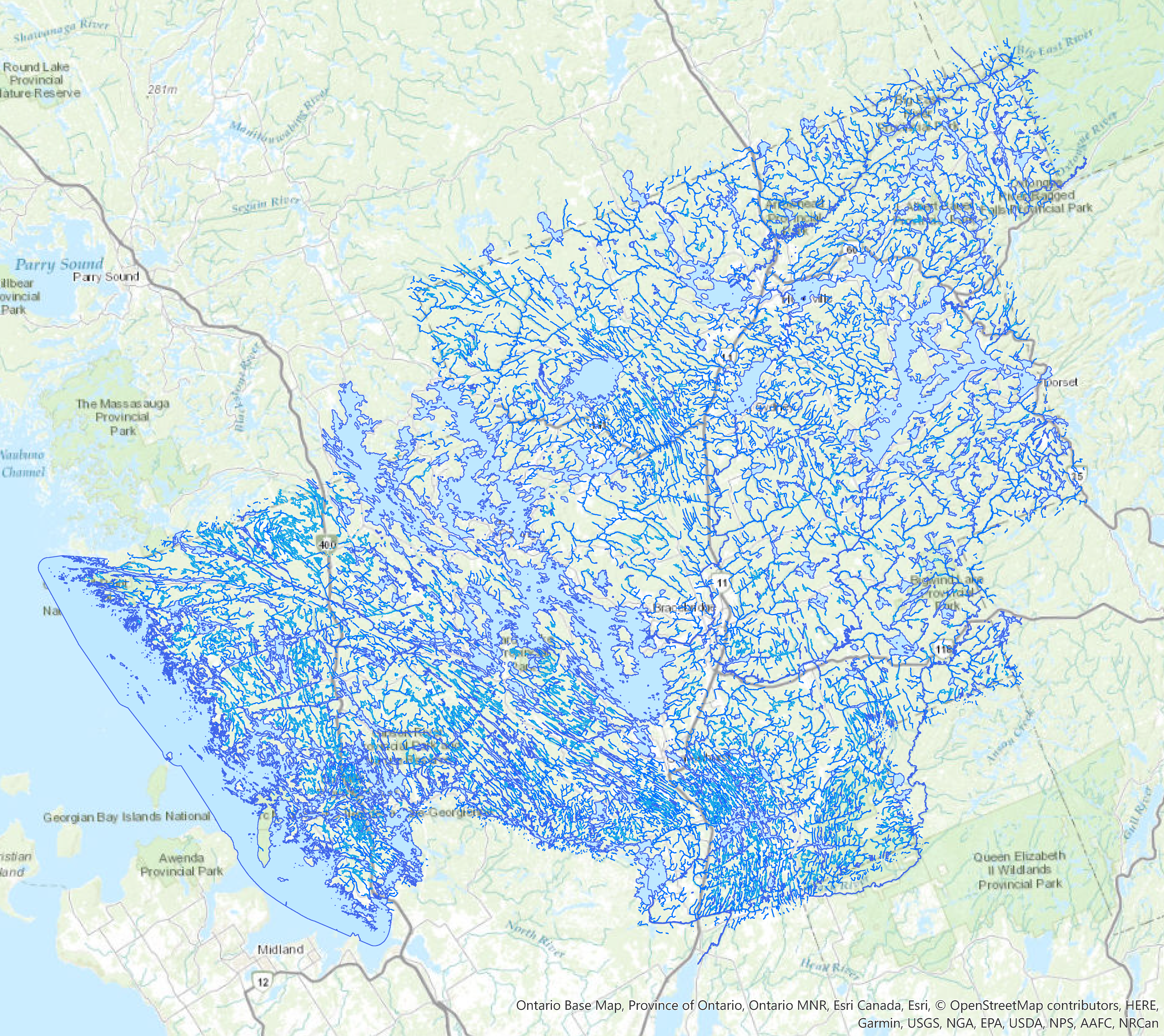
Most maps you see of Muskoka don’t include the full extent of our water resources, because if they did, you wouldn’t be able to see anything else. Instead, maps will usually show the 17 major river systems, including the Muskoka River, Big East River, Severn River, and Hoc Roc River. They will also show many of the 668 lakes eight hectares in size or larger, with the four largest lakes in Muskoka, Lake Muskoka, Lake Rosseau, Lake Joseph and Lake of Bays, the most recognizable.
DID YOU KNOW that Lake Muskoka is the largest lake in Muskoka? In fact, with a surface area of approximately 120 sq km, it is larger than Lakes Rosseau (64 sq km) and Joseph (53 sq km) combined, and almost twice as large as Muskoka’s second largest lake, Lake of Bays (68 sq km)!
While the major lakes and rivers in Muskoka are well documented, smaller water features are not as well known. To rectify this, a Natural Capital Inventory was created as part of the District of Muskoka’s “Making Waves Integrated Watershed Management Project”, funded by the Province of Ontario. The inventory collected additional information on first and second order streams, vernal pools, wetlands, and other Ecologically Significant Areas in the Muskoka River Watershed. Combined with existing data, the Natural Capital Inventory provides a more complete view of the natural features in Muskoka, which is necessary when developing an Integrated Watershed Management Plan.
Why is it important to have a better grasp of the location and extent of Muskoka’s natural resources? For a start, we have so much of it that it’s important to take them into consideration when making all land use decisions. For instance, Muskoka, at 4,774 sq km in size, is almost the size of Prince Edward Island, and water and water-related features, like wetlands, cover approximately 36% of this area.
All of these water features means that we have a lot of shoreline to consider. DID YOU KNOW that shorelines are among the most productive environments, according to the Love Your Lake program, with over 70% of land-based wildlife and 90% of aquatic life depending on shorelines during some point in their lives? This “ribbon of life” is everywhere in Muskoka; at over 13,400 km, Muskoka’s shorelines stretch almost 3x the width of Canada, and many of Muskoka’s 30 fish species, 250 bird species, 50 mammal species, and 25 reptile and amphibian species rely on them. This is a tremendous responsibility that we in Muskoka must accept and consider when making land use decisions.
And it’s not just shoreline residents that need to be aware of their impacts on water quality. DID YOU KNOW that you are never further than 1 km away from water when you are in Muskoka? This means that all development, whether directly on water or not, will have a significant impact on our water resources. What you do on the land, you will do to the water. Considering that Muskoka’s water helps support a $400 million tourism and recreation industry, we can’t afford to make land use decisions without taking into account the effect on our water resources, no matter how small and seemingly insignificant they may be.
The best way to do this is through the development of an Integrated Watershed Management Plan that allows us to manage human activities and natural resources, together, on a watershed basis, taking into account the connected interests and needs of the environment, economy and society. Muskoka can’t afford not to.

This article is one of Muskoka Watershed Council’s summer 2024 series on ““Living in Our Changing Watershed” published in MuskokaRegion.com. This week’s article was contributed by Rebecca Willison, Watershed Planning Technician with the Muskoka Watershed Council and District of Muskoka. Series editor is Dr. Neil Hutchinson, a retired aquatic scientist, Bracebridge resident and Director, Muskoka Watershed Council.